Análisis de variables biofísicas y cambios en el uso de la tierra en la cuenca del río Urasca (1997-2020), Cartago, Costa Rica
DOI:
https://doi.org/10.36829/63CTS.v12i1.1708Abstract
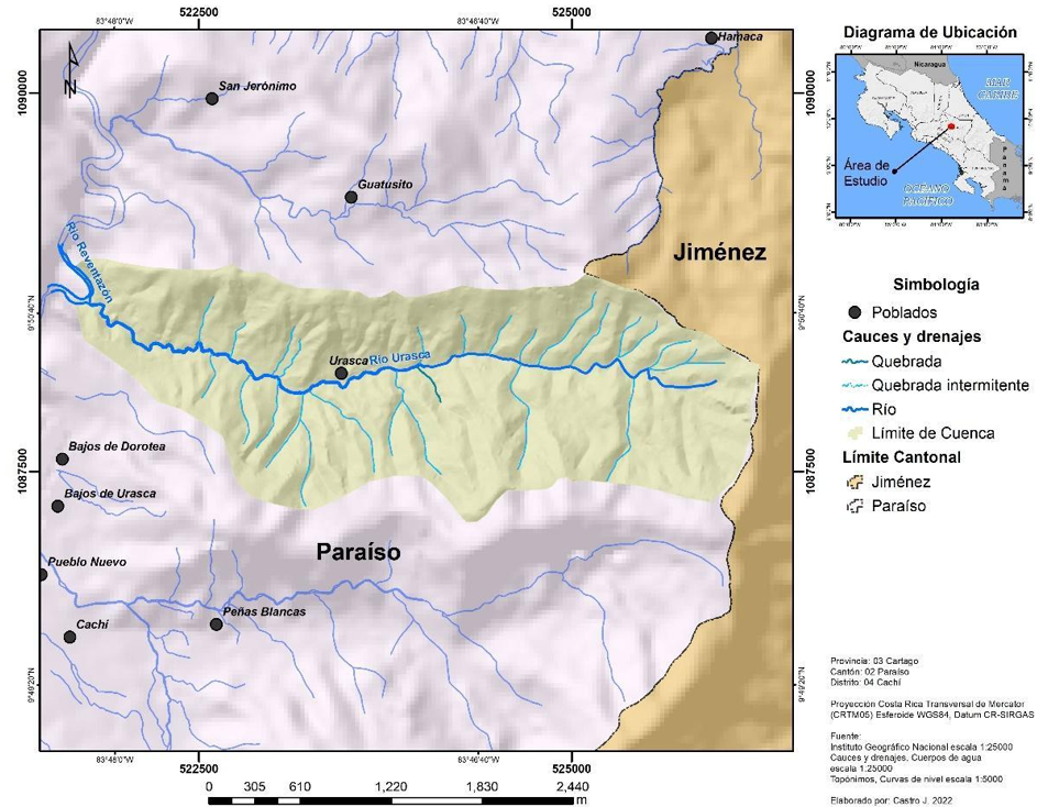
The water and environmental relevance of this region has increased due to the accelerated growth of the population and agricultural and tourist activities, generating pressure on natural resources and direct consequences on the springs. Therefore, an analysis of the state of biophysical variables and changes in land use was carried out for the period 1997 and 2020 in the Urasca River basin, using geographic information systems methodologies, primary and secondary information. The basin has an area of 5.4 km² and includes eight towns, Urasca being one of the most prominent among them. The distribution of land use in this area is diverse, with more than 50% of the territory covered by forests, 40% agricultural activities, and the rest of the land assigned to bodies of water, urban use and uncovered land. An increase of 1.8% in forest cover was observed, mainly due to the creation of protected areas and forest plantations in certain areas of the microbasin. In addition, there was a 43% increase in the area dedicated to crops, while the area dedicated to pastures experienced a decrease of almost 37%. The analysis provided a deeper understanding of the state of natural resources and identified characteristics of the region that could influence processes such as soil infiltration and water recharge. Favorable conditions are highlighted for the implementation of sustainable land management systems and contribute to preventing environmental degradation
Downloads
References
Acuña R. (1 de febrero de 2008). Sistema Nacional de Información Territorial. Curvas de nivel cada 10 metros 1:5000 Costa Rica. Recuperado el 20 de mayo del 2022 https://www.snitcr.go.cr/Metadatos/full_metadata2?k=Y2FwYTo6SUdOXzU6OmN1cnZhc181MDAw.
Acuña R. (14 de mayo de 2014). Sistema Nacional de Información Territorial. Cauce y Drenaje a escala 1:25000 Costa Rica. Recuperado el 20 de mayo del 2021 https://www.snitcr.go.cr/Metadatos/full_metadata2?k=Y2FwYTo6SUdOXzI1OjpjYXVjZWRyZW5hamVfMjVr
Álvarez Jiménez, M., Ramírez Granados, P., Castro Solís, J., & Solís Torres, L. (2021). Áreas de recarga hídrica potencial en las microcuencas del distrito de Cachi, Cartago, Costa Rica. UNED Research Journal, 13(2), e3683. https://doi.org/10.22458/urj.v13i2.3683
Acueductos y alcantarillado (AyA). (2020). Informe anual: cobertura y calidad del agua para consumo humano suministrado por municipalidades y la ESPH en el 2020. Recuperado https://www.aya.go.cr/Noticias/Documents/Informe%20Calidad%20y%20Cobertura%20Municipalidades%20y%20ESPH%202020.pdf
Arauz-Beita, I., & Arias-Navarro, A. (2016). Corredores biológicos como potenciadores del desarrollo local: Estudio de caso del corredor biológico Alexander Skutch. Universidad En Diálogo: Revista De Extensión, 6(1), 67-79. Recuperado a partir de https://www.revistas.una.ac.cr/index.php/dialogo/article/view/8449. https://doi.org/10.15359/udre.6-1.4
Berkes, F., Colding, J., Folke, C. (Eds.), 2003. Navigating Social-Ecological Systems: Building Resilience for Complexity and Change. Cambridge University Press, Cambridge, UK, p. 393.
Birhanu, S. Y., Moges, M. A., Sinshaw, B. G., Tefera, A. K., Atinkut, H. B., Fenta, H. M., & Berihun, M. L. (2022). Hydrological modeling with respect to impact of land-use and land-cover change on hydrological process and sediment yield, Case study in Jedeb and Chemoga watersheds. Energy Nexus, 100051. https://doi.org/10.1016/j.nexus.2022.100051
Bonansea, M., Bazán, R., Germán, A., Ferral, A., Beltramone, G., Cossavella, A., & Pinotti, L. (2021). Assessing land use and land cover change in Los Molinos reservoir watershed and the effect on the reservoir water quality. Journal of South American Earth Sciences, 108, 103243. https://doi.org/10.1016/j.jsames.2021.103243
Castillo, R., (1969). Geología de los mapas básicos de Abra y parte de río Grande, Costa Rica. Informes técnicos y notas geológicas, 33, 1-40.
Castellanos González, L., Francisca González-Pedraza, A., & Capacho Mogollón, A. E. (2021). Caracterización de los suelos de seis municipios en Norte de Santander. Inge-Cuc, 17(1), 69-80. https://doi.org/10.17981/ingecuc.17.1.2021.06 https://doi.org/10.19052/eq.vol1.iss37.2
Çelebi, A., Saarinen, T., Kløve, B., & Sengörur, B. (2014). Land use effects the surface water quality of some watersheds in north Finland and north Turkey. In Sustainable Watershed Management (pp. 191-192). CRC Press. https://doi.org/10.1201/b17433-40
Centro Científico Tropical (CCT). (1992). Capas de Zonas de Vida. Base de datos digitales.
Comisión Nacional de Emergencias (CNE). (2019). Capa de Amenazas Naturales. Base de datos digitales.
Comisión Nacional de Emergencias (CNE). (2009). Amenazas de origen natural cantón de Paraíso. Recuperado https://www.cne.go.cr/reduccion_riesgo/mapas_amenzas/mapas_de_amaneza/cartago/Paraiso%20-%20descripcion%20de%20amenazas.pdf.
Cortés, G; Víctor Ml. (2011). Agroecología del agroecosistema café (Coffea arabiga) y su relación con la erodabilidad de laderas en el Valle de Orosi, Cartago, Costa Rica. Anuario de Estudios Centroamericanos, 37(),271-305. [fecha de Consulta 28 de junio de 2022]. ISSN: 0377-7316. Disponible en: https://www.redalyc.org/articulo.oa?id=15237016011
Desta, H., & Fetene, A. (2020). Land-use and land-cover change in Lake Ziway watershed of the Ethiopian Central Rift Valley Region and its environmental impacts. Land Use Policy, 96, 104682. https://doi.org/10.1016/j.landusepol.2020.104682
Escalante, G. (1966). Geología de la cuenca superior del río Reventazón, Costa Rica. Publicaciones Geológicas del ICAITI, 50.
Fedele, G., Locatelli, B., Djoudi, H., Colloff, M.J., (2018). Reducing risks by transforming landscapes: cross-scale effects of land-use changes on ecosystem services. PLoS One 13 (4), 1-21. https://doi.org/10.1371/journal.pone.0195895. https://doi.org/10.1371/journal.pone.0195895.PMid:29689062 PMCid:PMC5916864
Foley, J.A., DeFries, R., Asner, G.P., Barford, C., Bonan, G., Carpenter, S.R., Chapin, F.S., Coe, M.T., Daily, G.C., Gibbs, H.K., Helkowski, J.H., Holloway, T., Howard, E.A., Kucharik, C.J., Monfreda, C., Patz, J.A., Prentice, I.C., Ramankutty, N., Snyder, P.K., (2005). Global consequences of land use. Science 309 (5734), 570-574. https://doi. org/10.1126/science.1111772. https://doi.org/10.1126/science.1111772 PMid:16040698
Galván Fernández, A., & Márquez García, A. Z. (2017). Descripción biofísica de la cuenca del río Coapa, Chiapas. HIDROBIOLÓGICA, 16(2), 107-120.
Henríquez-Henríquez, C., & Cabalceta-Aguilar, G. (1999). Principales suelos de Costa Rica. Recuperado en http://www.infoagro.go.cr/Inforegiones/RegionCentralOriental/Documents/Suelos/tipos%20de%20suelos%20CR.pdf.
Hutchinson, M. F. (1993). Development of a continent-wide DEM with applications to terrain and climate analysis., En M. Goodchild, Parks, B. & L. Steyaert (eds), Environmental Modeling with GIS (p. 392-399). New York, Estados Unidos: Oxford University Press.
Instituto Costarricense de Electricidad (ICE). (2009). Estudio de Impacto Ambiental Proyecto de Modernización y Ampliación Planta Hidroeléctrica Cachí. Expediente Administrativo D1-1382-2007, resolución N 579-2088 SETENA. Recuperado https://www.eib.org/attachments/registers/53219893.pdf.
Instituto de Desarrollo Rural (INDER). (2016). Caracterización del Territorio: Paraíso-Alvarado. 42 p. Recuperado en https://www.inder.go.cr/istaru/Caracterizacion-Territorio-Paraiso-Alvarado.pdf.
Instituto de Desarrollo Rural (INDER). (2016). Plan de desarrollo rural territorial territorio Paraíso-Alvarado 2016-2021. 107 p. Recuperado en https://www.inder.go.cr/istaru/PDRT-Paraiso-Alvarado.pdf.
Instituto del Café (2019). Informe Final de Proyecto: Actualización área cafetalera 2017-2018.Heredia, Costa Rica. Recuperado en http://www.icafe.cr/wp-content/uploads/cicafe/documentos/Actualizacion-Area-Cafetalera-2017-2018.pdf.
Joyce, Armond T. 2006. Land use change in Costa Rica: as influenced by social, economic, political 1966-2006. San José Costa Rica Imprenta LIL S.A. 276 pp.
Mariye, M., Jianhua, L., & Maryo, M. (2022). Land use and land cover change, and analysis of its drivers in Ojoje watershed, Southern Ethiopia. Heliyon, 8(4), e09267. https://doi.org/10.1016/j.heliyon.2022.e09267. PMid:35479852 PMCid:PMC9035721
Montoya, L., & Masser, I. (2005). Management of natural hazard risk in Cartago, Costa Rica. Habitat International, 29(3), 493-509. https://doi.org/10.1016/j.habitatint.2004.04.003
Montero, W., Linkimer, L., & Rojas, W. (2016). El sistema de falla Navarro: desplazamientos izquierdos a lo largo del cinturón deformado del centro de Costa Rica. Revista Geológica de América Central, (55), 71-100. https://doi.org/10.15517/rgac.v55i0.27062
Murrieta, E; Finegan, B; Delgado, D; Villalobos, R; Campos, JJ. (2007b). Identificación y caracterización florística de bosques naturales en el Corredor Biológico Volcánica Central Talamanca, Costa Rica. Recursos Naturales y Ambiente 51-52:57-68.
Luiza Amante, B. (2020). La conectividad funcional y los servicios ecosistémicos proporcionados por abejas en los agropaisajes del Corredor Biológico Volcánica Central Talamanca, Costa Rica [Tesis de Doctorado, CATIE]. Repositorio Institucional- CATIE.
Ostrom, E., (2009). A general framework for analyzing sustainability of social-ecological systems. Science 325, 419-422. https://doi.org/10.1126/science.1172133 PMid:19628857
Palacios-Cabrera, T., Valdes-Abellan, J., Jodar-Abellan, A., & Rodrigo-Comino, J. (2022). Land-use changes and precipitation cycles to understand hydrodynamic responses in semiarid Mediterranean karstic watersheds. Science of The Total Environment, 153182. https://doi.org/10.1016/j.scitotenv.2022.153182. PMid:35045347
Patel, S.K., Verma, P., Singh, G.S., 2019. Agricultural growth and land use land cover change in peri-urban India. Environ. Monit. Assess. 191 (9), 1-17. doi:10.1007/s10661-019-7736-1. https://doi.org/10.1007/s10661-019-7736-1. PMid:31468148
Programa Mundial de las Naciones Unidas de Evaluación de los Recursos Hídricos (WWAP). (2018). Informe mundial de las Naciones Unidas sobre el desarrollo de los recursos hídricos 2018: soluciones basadas en la naturaleza para la gestión del agua.
Rodríguez Orduz, D. A. (2018). Caracterización biofísica y análisis de amenazas para la Cuenca del Río Monquirá como insumo en la fase de diagnóstico del Plan de Ordenación y Manejo de Cuenca Hidrográfica (POMCA).
Rodríguez, J.P., Beard, T.D., Bennett, E.M., Cumming, G.S., Cork, S.J., Agard, J., Dobson, A.P., Peterson, G.D., (2006). Trade-offs across space, time, and ecosystem services. Ecol. Soc. 11 (1) https://doi.org/10.5751/ES-01667-110128. https://doi.org/10.5751/ES-01667-110128
Rojas, N. (2011). Instituto Meteorológico Nacional. Estudio de Cuencas Hidrográficas de Costa Rica. Cuenca del Río Reventazón. Recuperado el 24-11-2021 http://cglobal.imn.ac.cr/documentos/publicaciones/EstudioCuencas/EstudioCuencas-cuencaRioReventazon.pdf
Saucedo-Ramírez, O. A., Mahlknecht, J., & González-Bravo, R. (2022). Optimization of water allocation networks in highly engineered basins: The case of Guandu River basin, Rio de Janeiro State, Brazil. Journal of Cleaner Production, 358, 131787. https://doi.org/10.1016/j.jclepro.2022.131787
Siles, J., & Soares, D. (2003). La fuerza de la corriente: Gestión de cuencas hidrográficas con equidad de género.
Sojo, D., Denyer, P., Gazel, E., & Alvarado, G. (2017). Geología del cuadrante Tapantí (1: 50 000), Costa Rica. Revista Geológica de América Central, (56), 83-116. https://doi.org/10.15517/rgac.v0i56.29238
T ̈ornqvist, R., Jarsj ̈o, J., Pietro ́n, J., Bring, A., Rogberg, P., Asokan, S.M., Destouni, G., 2014. Evolution of the hydro-climate system in the Lake Baikal basin. J. Hydrol. 519, 1953-1962. https://doi.org/10.1016/j.jhydrol.2014.09.074
UN-Water, 2020. United Nations World Water Assessment Programme (WWAP). The United Nations World Water Development Report 2020: Water and Climate Change. UNESCO, París.
Watler R., W., Faustino M., J. y los miembros del Centro Agronómico Tropical de Investigación y Enseñanza. (2013, 1 de julio-30 de septiembre). Curso internacional en línea de especialización en "Gestión integral de cuencas hidrográficas": Construcción del Plan de Gestión de Cuencas Hidrográficas. (Unidad 2) [curso en línea]. CATIE.
Walia, C. S., Singh, S. P., Dhankar, R. P., Ram, J., Kamble, K. H., & Katiyar, D. K. (2010). Watershed characterization and soil resource mapping for land use planning of Moolbari Watershed, Shimla District, Himachal Pradesh in Lesser Himalayas. Current Science (00113891), 98(2), 176-182.
Zerga, B., Warkineh, B., Teketay, D., Woldetsadik, M., & Sahle, M. (2021). Land use and land cover changes driven by expansion of eucalypt plantations in the Western Gurage Watersheds, Centeral-south Ethiopia. Trees, Forests and People, 5, 100087. https://doi.org/10.1016/j.tfp.2021.100087
Downloads
Published
How to Cite
Issue
Section
License
Copyright (c) 2025 Maria Alvarez Jimenez, José Castro Solís

This work is licensed under a Creative Commons Attribution-NonCommercial-ShareAlike 4.0 International License.
El autor que publique en esta revista acepta las siguientes condiciones:
- El autor otorga a la Dirección General de Investigación el derecho de editar, reproducir, publicar y difundir el manuscrito en forma impresa o electrónica en la revista Ciencia, Tecnología y Salud.
- La Direción General de Investigación otorgará a la obra una licencia Creative Commons Atribución-NoComercial-CompartirIgual 4.0 Internacional